It first flows as a small stream westward into Angola before it swings back into Zambia 240km later. Here the river leaves the flood plains and drops in elevation through a series of rapids from Cholwezi to the Chavuma Falls.
From here, the Zambezi crosses the Barotse flatlands, once the northern extension of the Kalahari Desert. At times in the rainy season, the river turns into a 25km-wide swamp on these flood plains, before it narrows again turning southeast into rocky country from where it tumbles over the broad, low Ngonye Falls.
The river then cuts through the Caprivi Swamps where it is joined by the Chobe River. By the time the Zambezi reaches Victoria Falls, 1 200km from its source, it is a great watercourse 2km wide. The Falls divide the upper and middle Zambezi Rivers. Below the Falls the river rages over a number of rapids in the 8km of zig-zag canyons that were the previous incarnations of the Victoria Falls.
For the next 100km the Zambezi flows through the wild Batoka Gorge, one of the most inaccessible parts of Africa. Here the river has carved its way deep into the ancient basalt - at times the water level is 350m below the surrounding plains.
There are many other waterfalls on the tributary rivers that join the Zambezi during its course through the Batoka Gorge. Among the most impressive are the Masui Falls, a 110m drop where the Masui River flows over the sixth Zambezi gorge from the Zimbabwean side, and the Songwe Falls where the Songwe River drops into a gorge of the same name on the Zambian side of the river.
Thirty-six kilometres below Victoria Falls are the Chimamba Rapids, where the gorge is barely 20m in width and the river thunders through the channel with an awesome force.
At the eastern end of Batoka Gorge, the Zambezi is released into the broad Gwembe Valley, an area dammed in 1959 to form Lake Kariba.
Below Kariba, the Zambezi is joined by the Kafue and Luangwa Rivers where it enters Mozambique. It passes over the Cabora Bassa Rapids into a dam of the same name. The Cabora Bassa dam wall marks the start of the Lower Zambezi.
From here to the coast, 600km away, the river is shallow, although navigable during the rainy season as it passes across broad flood plains, often breaking up into several watercourses, before depositing its waters into the Indian Ocean, some 2 700km from its origins.
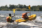
Brett Hilton-Barber and Lee R. Berger. Copyright © 2010 Prime Origins. An incredible adventure holiday for those looking for a new and exciting experience, a canoeing holiday down the Lower Zambezi River....
 The Zambezi River is the fourth largest river in Africa. There are numerous day trips, tours and excellent Zambezi River Safari Lodges in Za...